Center for Geospatial Intelligence and Environmental Security
![]()
Welcome to the Center for Geospatial Intelligence and Environmental Security
Our Mission
The Center for Geospatial Intelligence and Environmental Security (CGIES) was established in 2019 at Kentucky State University with support from the NSF-HBCU-UP Grant Initiative. The Center conducts cutting-edge, transdisciplinary research and education on environmental stewardship, agroecosystem change, and the application of GIS and remote sensing to advance understanding of the Human-Environment-Ecosystems Relationship in Kentucky. Specifically, the CGIES strengthens environmental resilience and ecosystem sustainability through advanced geospatial science, remote sensing, unmanned aerial systems (UAS), lidar technologies, and integrated field-based data collection and monitoring. The Center develops high-impact graduate thesis research on environmental intelligence to support ecosystem restoration, natural resource protection, alternative land management, and the study of extreme-weather impacts, particularly in environmentally vulnerable and economically dependent regions, such as the coal-dominant regions of Eastern Kentucky.

Overview
Team
Grants
Research Projects
Publications
News
Check out for what's happenning !!!
Presentations
Lab Activities
What we do
1) Develop a long-term environmental benchmark database
Establish a standardized geospatial database of soil and water quality for reclaimed mine sites and reference ecosystems to support long term monitoring and comparisions.
2) Advanced aerial monitoring of vegetation recovery and ecosystem health
Use satellite data, UAV multispectral imagery, and lidar-derived indices to quantify vegetation dynamics, growth patterns, biomass trends, and reclamation sucess across disturbed landscapes.
3) Quantify soil erosion and land degradation risks
Apply geospatial modelling approaches such as USLE, RUSLE, SWAT etc frameworks to estimate soil loss, sediment movement and erosion hotspots and evaluate the effectiveness of reclamation strategies in reduce land degradation
4) Stregthen microclimate monitoring and ecosystem exchange observations
Implement continuous monitoring of CO2 and water vapor exchange, precipitation, wind, soil moisture, radiation and humidity to support long-term studies of CO2 exchange characterization, regrowth phenology, biomass-productivity, water, vegetation, and carbon balance, remotely sensed data validation, and other research and education activities with local high schools, stakeholders, and agencies.
5) Promote workforce development through student training, certificate courses, STEM
program and applied research
Provide hands-on training for students, in GIS, remote sensing, UAV/lidar data processing, field sampling, geospatial modelling and cerficate courses on GIS/ remote sensing and climate change studies.
6) Human-environment vulnerability assessments
Conduct research that connect environmental change with community vulnerability and equity related outcomes to improve inclusive planning, and targeted risk reduction in high-impact regions.
7) Interdisciplinary partnerships and research collaborations
Stregthen collaborations with universities, agencies, high schools, and community stakeholders to support data sharing, research translation, and scalable environment solutions across watersheds and reclaimed regions
8) Produce research outputs and publish evidence-based solutions
Generate high quality scientific outputs including peer-reviewed publications, and conference presentations that strengthen the credibility and impact of the research projects.
STEM URA Experience
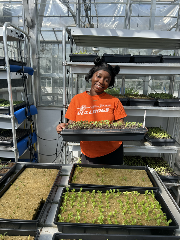
During my STEM URA journey, I worked on three hands-on research projects: investigating how different fertilization practices influence seedling development, analyzing how various production systems affect the growth of Early Girl tomatoes, and exploring the potential of square-foot gardening as a sustainable method for enhancing local food production in Kentucky. Throughout this experience, I connected with many supportive and knowledgeable individuals who offered valuable insights that helped shape my career goals in agriculture. I also had the opportunity to visit Frankfort’s Humane Society with Ms. Gae Broadwater, work on the farm, and collaborate with professors and graduate students. These experiences allowed me to learn more about the innovative research being conducted by other STEM students.
TyMeisha Smith, Agriculture Systems Major, Senior
This semester, my STEM Undergraduate Research Assistant experience focused on my project, “Rural vs. Urban Differences in Diabetes Prevalence in the United States.” I analyzed national health datasets to compare diabetes trends across rural and urban populations, looking at contributing factors such as access to care, socioeconomic status, and lifestyle patterns. Through this project, I strengthened my skills in data interpretation, literature review, and understanding health disparities. This research helped me see how geography shapes health outcomes and reinforced my interest in public health, healthcare access, and clinical research.
Timiyah Roberson, Biology Major, Senior
As a STEM URA, I worked on a research project titled Maternal Mortality in Kentucky: Understanding Causes and Preventions. My work focused on reviewing existing data and studies to understand why Kentucky has one of the highest maternal mortality rates in the country. I learned how to analyze both medical and social factors, like access to care, poverty, and racial disparities. This project helped me build strong skills in literature review, data interpretation, and public health research. It also made me more aware of how policy, healthcare access, and community conditions shape maternal health. Being part of the STEM URA program gave me hands-on research experience, mentorship, and the chance to contribute to a real public health issue that affects families in Kentucky.
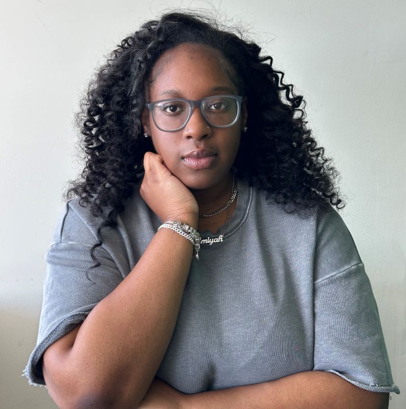
Narimane, Psychology Major